Kilimanjaro and Mount Meru
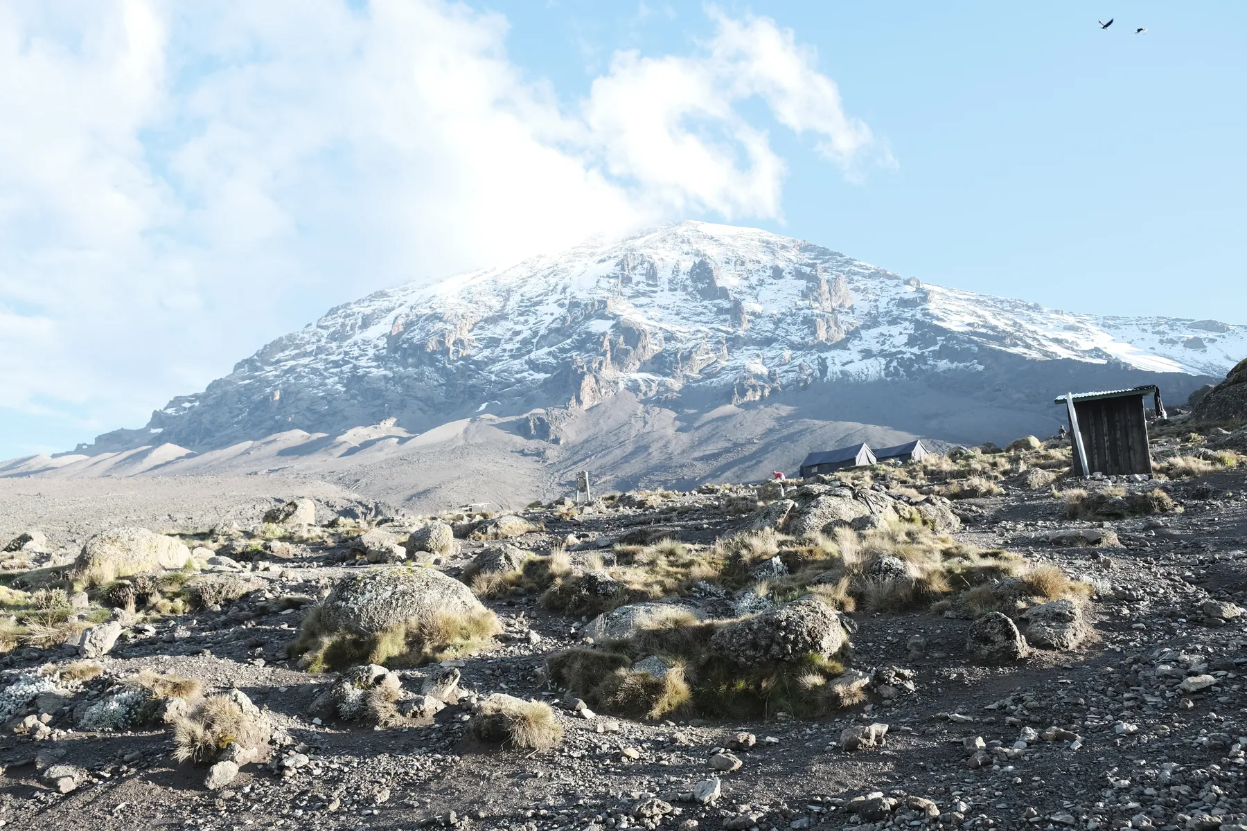
Kilimanjaro is Africa's highest peak, reaching Uhuru Peak at 5,895 metres. Its routes cross cultivated slopes, rainforest, moorland, alpine desert and a cold summit environment. Mount Meru, at approximately 4,566 metres inside Arusha National Park, offers forest, wildlife-rich slopes, a volcanic crater and views towards Kilimanjaro.
Both are serious climbs. Health, weather, acclimatisation, route conditions and qualified guides' decisions determine whether a summit attempt is safe and feasible.
Kilimanjaro routes
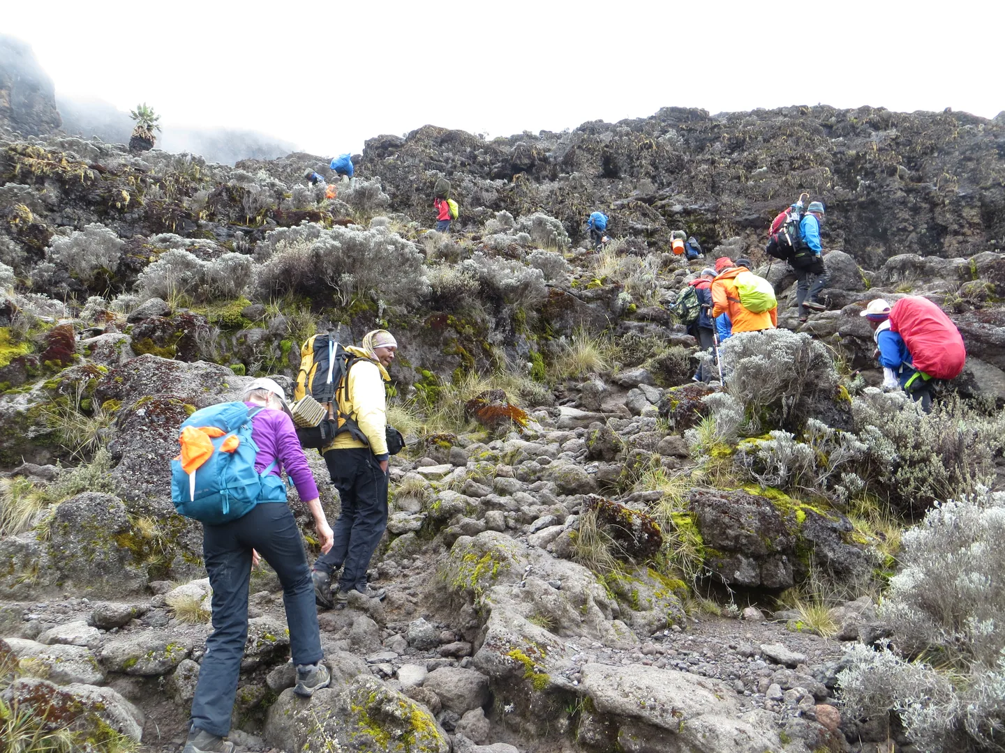
There is no single Kilimanjaro climb. Routes approach the mountain from different directions, differ in sleeping arrangements and allow different amounts of time to adapt to altitude.
Marangu
Marangu is the established hut-based approach. Its accommodation is a defining feature: visitors sleep in mountain huts rather than the tented camps used on many other routes. The ascent commonly passes Mandara, Horombo and Kibo huts towards the summit area via Gilman's Point.
Huts and moderate lower slopes do not make Marangu easy. The altitude and summit effort remain substantial, especially with a compressed ascent. Five- and six-day Marangu ascents are commonly described, including a possible extra acclimatisation day around Horombo. The important difference is the time allowed for altitude adaptation, not simply the number of nights in huts.
Machame
Machame approaches from the south and is known for varied mountain scenery, the Barranco Wall and a route that allows changes in altitude across successive days. It is commonly described as a six- or seven-day climb. Its character is more demanding and camp-based than Marangu's hut approach, though the practical difficulty depends on the actual route duration and conditions.
Lemosho
Lemosho approaches from the west, crossing different ecosystems before joining the broader summit routes. Its longer commonly advertised durations—often seven or eight days—may offer greater opportunity for acclimatisation and for experiencing the mountain's varied landscapes. 'Longer' should not be confused with an assured summit.
Rongai
Rongai approaches from the generally quieter northern side, offering a different perspective on Kibo and Mawenzi. Often undertaken over six or seven days, it has its own weather patterns, camps, route conditions and descent arrangements.
Umbwe
Umbwe is steep and direct. It appeals to some experienced hikers but allows less natural time for acclimatisation. Choosing it for speed alone overlooks the altitude risk; the route and ascent profile require assessment with a competent licensed operator.
Northern Circuit
The Northern Circuit follows a longer route around the mountain, offering varied high-altitude landscapes and more time at elevation. Compare its time commitment, acclimatisation, weather exposure and support requirements rather than marketing claims.
Mawenzi technical climbing
Mawenzi is a separate volcanic cone with technical climbing objectives distinct from an ordinary trek to Uhuru Peak. An ascent requires specialist equipment, suitable experience, qualified support and specific permissions. It should be planned as a technical climb rather than a casual extension of a standard walking route.
Kilimanjaro's changing environments
Cultivated lower slopes
Coffee, banana and other farms give way to protected mountain habitats. This zone is also connected to the lives and economies of communities near the mountain. A climb begins in a lived-in landscape, not at an empty wilderness boundary.
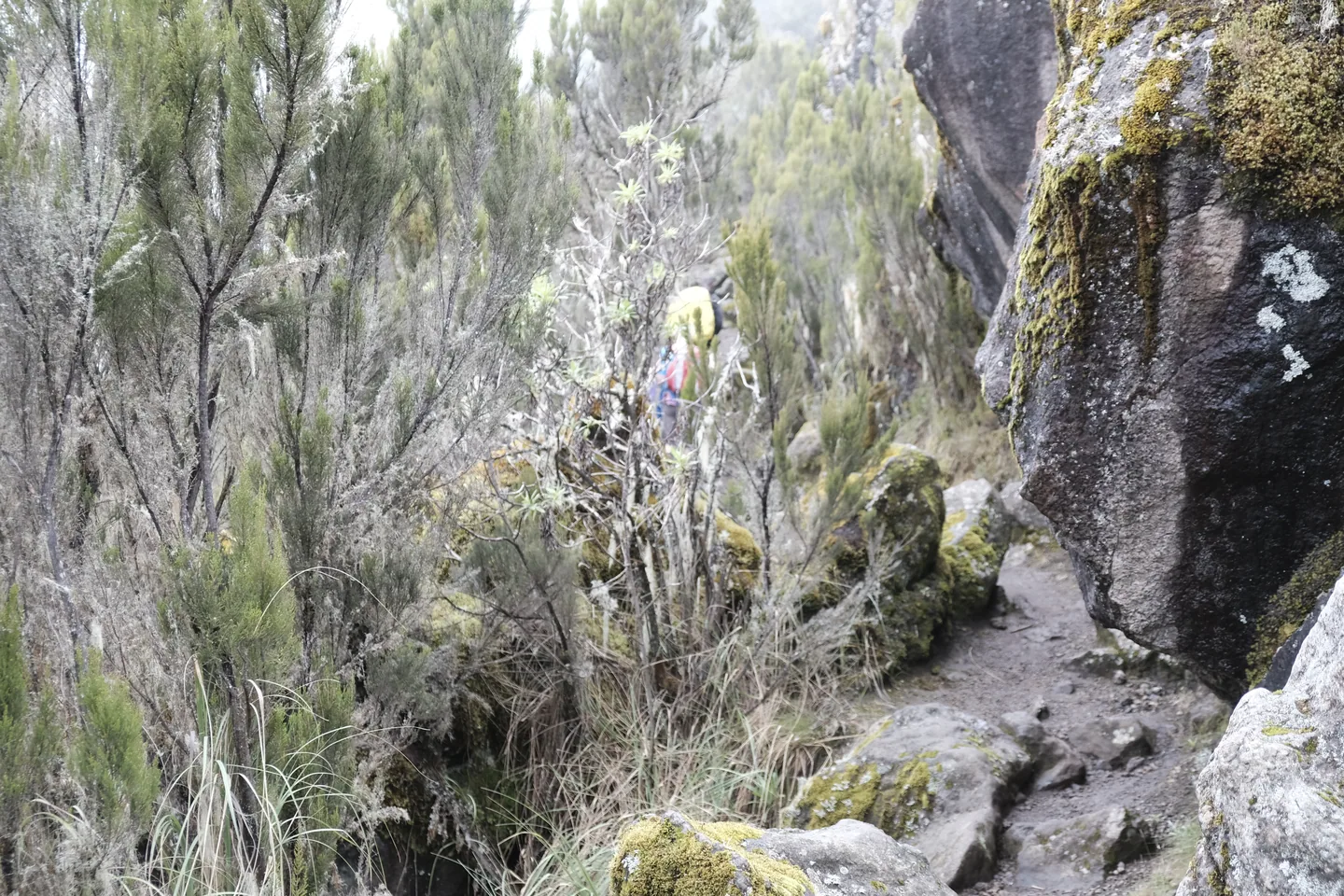
Montane forest
Rainfall supports tall forest, including habitat for blue and black-and-white colobus monkeys and many bird species. Paths may be muddy and shaded. Wildlife observations are possible but not the purpose or guarantee of a summit climb.
Moorland
Above the forest, plants such as giant groundsels and lobelias mark a striking change. Temperatures vary and cloud can arrive quickly. Walking becomes more exposed as altitude rises.
Alpine desert
Vegetation thins and the mountain becomes harsher: sun, wind and large temperature changes can occur over a single day. Energy conservation and acclimatisation matter increasingly.
Summit environment
Above about 5,000 metres, cold, wind, low oxygen availability and potentially ice or snow create a demanding final environment. These vegetation zones change gradually with height and exposure rather than at exact lines on a map.
A tropical location does not make Kilimanjaro a warm-weather summit.
Mount Meru
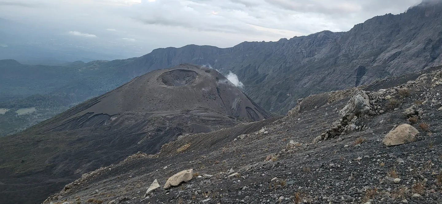
Meru's principal established climbing approach is the Momella Route through Arusha National Park. It crosses lower forest and open habitats into higher mountain terrain, with huts commonly associated with the ascent and a final climb towards Socialist Peak along the volcanic crater rim.
The lower slopes may provide sightings of giraffes, monkeys, buffalo or birds, depending on conditions and route. The crater and ash cone give Meru a distinctive geological character. On clear days there are views of Kilimanjaro.
Meru is commonly climbed over three or four days, allowing time to experience the mountain beyond the summit push. Actual permitted duration, guide and armed-ranger requirements, huts, transport and availability must be checked against current TANAPA rules. The ascent can be an appealing independent mountain experience as well as part of preparation for longer mountain travel.
Walking before a high-altitude climb
A short guided walk on Meru's lower slopes introduces local terrain, wildlife and walking conditions. Kilimanjaro's summit demands a separate acclimatisation plan that accounts for sustained time at altitude.
How to choose between Kilimanjaro and Meru
| Question | Kilimanjaro | Mount Meru |
|---|---|---|
| What is the central challenge? | A much higher summit, prolonged altitude exposure and diverse routes | A volcanic-rim ascent with substantial climbing and forest-to-alpine changes |
| What varies most? | Route, duration, acclimatisation profile and hut/camp accommodation | Duration, conditions and the guided Momella ascent |
| What landscapes stand out? | Forest, moorland, high-altitude desert, Kibo and Mawenzi | Forest, wildlife-rich lower slopes, crater and ash cone |
| What deserves particular attention? | Altitude sickness, summit weather, support crew and route choice | Steep terrain, exposure, weather and park/ranger requirements |
| Is one objectively better? | No | No |
When to climb
Climbers often investigate January–February and parts of August–October for comparatively dry or stable conditions. June–July can feel cooler, while the lower slopes are generally warmer around December–March. Meru's drier walking period is often associated with June–October.
These categories overlap because temperature, rainfall, wind, trail conditions and altitude are different dimensions. A dry lower trail is not a guarantee of a clear, calm summit; mountain conditions can change rapidly. Confirm the route-specific seasonal advice and weather outlook before the climb.
Explore Tanzania's seasonal patterns.
Preparing for the mountain
Altitude. Symptoms of acute mountain sickness can occur even in fit travellers. Take acclimatisation seriously, choose a suitable ascent profile, report symptoms and follow guide instructions. Do not frame summit success as a matter of willpower.
Guides and support. TANAPA's visitor guidance describes guided climbing with licensed operators. Mountaineering services may involve guides, porters, cooks, rangers and rescue-related obligations. The arrangements and protections owed to the crew should be understood before choosing a provider.
Equipment. Clothing and equipment must cover rain, wind, strong sun and near-freezing or freezing conditions. Footwear, sleeping arrangements, headlamp, hydration and personal medical preparation are not optional details.
Accommodation. Marangu's huts differ from the tented arrangements on other routes. On Meru, hut capacity and park arrangements are separate considerations. Neither a route description nor a published fee proves a bed or campsite booking.
Travel and access. Gates, transfers from Moshi or Arusha, departure-day arrangements and transport after the climb must be established separately from the time spent on the mountain.
Permissions and route limits. General trekking, specialised climbing, paragliding, cycling and other mountain activities do not share identical permits or liabilities. The apparent availability of an activity in a brochure does not grant permission to undertake it anywhere on the mountain.
Fees and other costs
The protected-area charges may include conservation, huts or camping, rescue and applicable ranger, crew or activity fees. A provider's overall price may also include guides, porters, meals, equipment, accommodation and transport. Ask what is included, how the crew is supported and which costs remain separate.
Browse climbing-related official fees.
Calculate applicable protected-area fees.
Explore Trip Scheduling for its supported protected-area activity and climbing arrangements; it does not confirm an operator, crew, transport or altitude safety.
Beyond the climb
Arusha and Moshi offer museums, markets, coffee-growing landscapes and local culture. Arusha National Park's walking opportunities can also interest visitors who would like a different encounter before or after a mountain journey. Such experiences should be considered individually, with host permission and applicable park rules, not assumed to come with a climbing fee.
Explore culture and short local experiences.
Other mountain landscapes
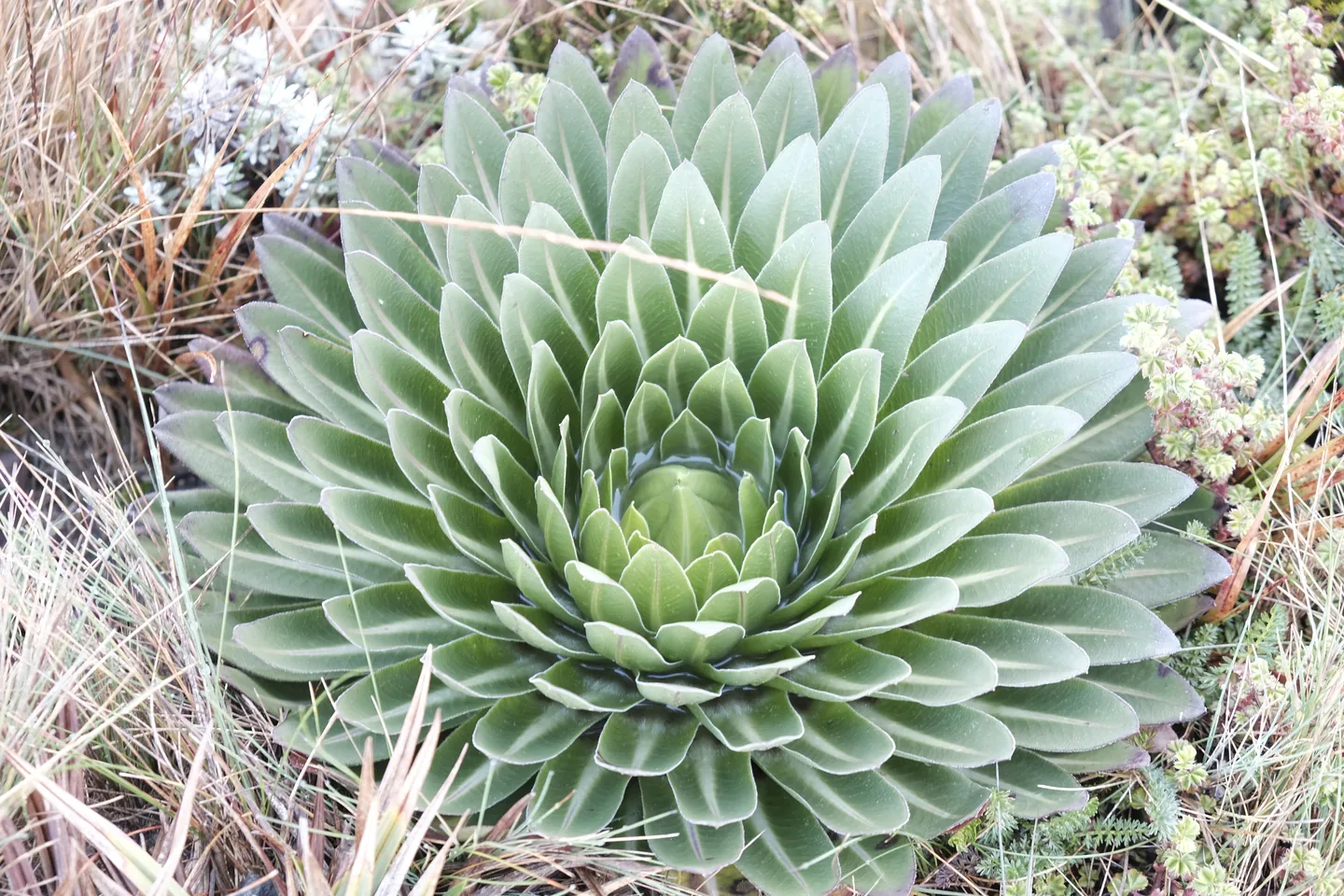
Uluguru, Usambara and Udzungwa offer something very different from the Kilimanjaro ascent: forest ecology, waterfalls, birdwatching and walking through distinctive mountain landscapes. Loolmalassin and Ol Doinyo Lengai belong to the volcanic setting of the Ngorongoro Highlands, where climbing demands and permissions differ.
A hiker who already knows Kilimanjaro may find more interesting contrasts in the forest endemism of Amani, the Uluguru mountain communities, Udzungwa's walking environments or the active-volcano setting of Lengai. None is an automatic substitute for a guided Kilimanjaro ascent. Each requires its own arrangements and permissions.
Explore the Eastern Arc Mountains and Ngorongoro Highlands.
Life around the mountains
Around Moshi, Materuni, Lyamungo, Nshupu, Kisangara, Mirerani and the Chagga highlands, local hosts may offer visits focused on coffee and banana growing, crafts, beekeeping and enterprise. These connect the mountain landscape with everyday livelihoods. Mangi Meli's history is a particular subject deserving serious treatment rather than a casual cultural add-on.
Local hosts and institutions can explain these places in ways that make the mountain region's history and everyday work tangible. Agree any farm, workshop or cultural visit with those responsible for it.